Tapti Fm
Type Locality and Naming
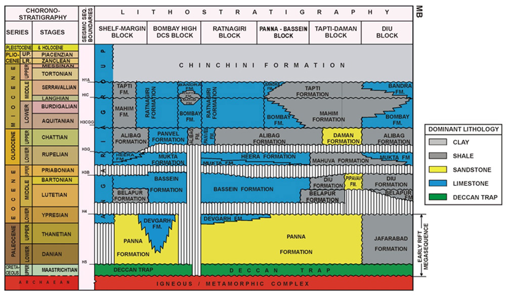
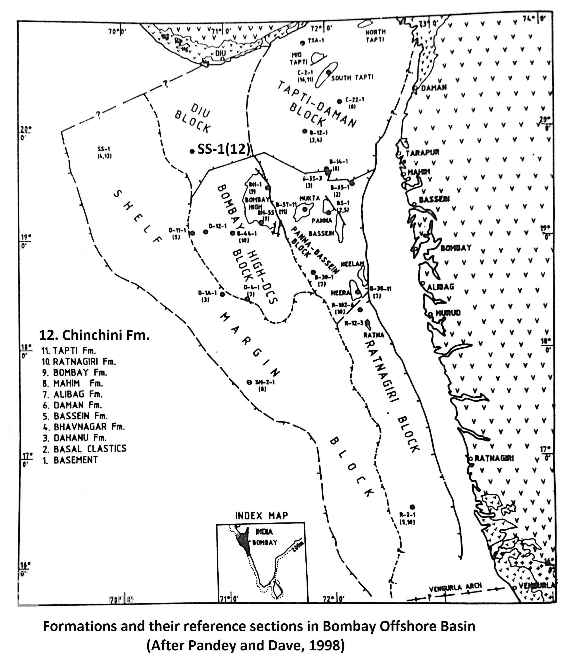
The interval between 900 m to 1500 m in the well South Tapti-1 (C-2-1) was designated as Tapti Formation by Basu et al. (1982). The lower contact of the formation was defined by them on the basis of shale density and interval velocity break and the upper contact was defined on the basis of regional disconformities identified on the seismic data. Reference Well C–2 -1, (depth interval 900 – 1500 m). [Original Publication: Basu, D.N., Banerjee, A and Tamhane, D.M. 1982. Facies distribution and petroleum geology of Bombay Offshore Basin, India. Journal Petroleum Geology, Volume 5, pp. 57-75.]
[Figure: Lithostratigraphy in Mumbai Offshore blocks (from NDRDGH.gov.in; after Jitendra Misra, 2009)]
Lithology and Thickness
Claystone. In the type area, the formation consists dominantly of shales with minor siltstone layers. The shale is greenish-grey to brownish, moderately hard, frequently silty and splintery. In reference well, this formation is represented dominantly by shale facies interspersed with thin limestone bands in its upper part. Base of the formation is invariably represented by a 15-20 m thick siltstone marker bed. The shales in this area are light grey to brownish-grey, moderately hard, poorly fissile, fossiliferous, pyritic and carbonaceous (Zutshi et al., 1993).
The formation is 377 m thick in the type section which reduces to 243 m in the reference well B-51-11. Due south and west, thickness progressively decreases.
[Figure 1: Formations and their reference sections in Mumbai Offshore Basin (after Pandey and Dave, 1998)]
Relationships and Distribution
Lower contact
The formation is unconformably underlain by Mahim Fm.
Upper contact
A basin-wide disconformity separates this formation from overlying Tarapur Fm.
Regional extent
GeoJSON
Fossils
In the type area, top of the formation lies close to the top of Cycloclypeus indopacificus / Miogypsina antillea Zone (Pandey and Guha, 1979) and Middle Miocene to Upper Miocene unconformity (Reflector H1).
Age
Depositional setting
Except for minor rise in the sea level, the depositional environment remained more or less similar to that of the underlying Mahim Fm. The Tapti Formation is generally characterized by prodelta muds which got dispersed to areas as far off as Shelf Margin depression.
Additional Information

